Verified Land.
Zero Litigation Risk.
Every parcel on LandCleared undergo a 5-Layer Legal Audit — cross-referencing Dharani 1-B revenue records, 31-year Encumbrance Certificates, HMDA/GHMC Masterplan zoning, and satellite demarcation.
Explore Verified Telangana Land Parcels
Filter by zone, acreage, and risk score. Toggle HMDA Masterplan 2031 overlays to inspect boundary alignments.
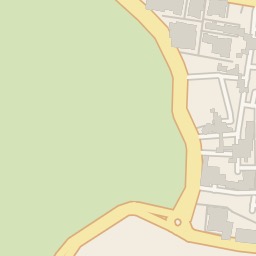
4.5 Acres Agricultural Land
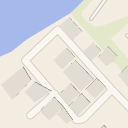
267 Sq Yds Residential Plot
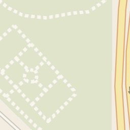
12 Acres Farm Land — Mango Orchard
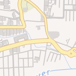
Commercial Plot 1,200 Sq Yds
8 Acres Agricultural Land
Residential Plots 150–300 Sq Yds
3.2 Acres Agricultural Land
Commercial Corner Plot 800 Sq Yds
20 Acres Farm Land with Pond
Residential Plot — Approved Layout
5 Acres Near TSIIC Industrial Zone
Villa Plot in Gated Layout
Featured Verified Landbanks
Every parcel includes a published 5-Layer Land Clearance Certificate & 31-Year Encumbrance Audit.
4.5 Acres Agricultural Land
267 Sq Yds Residential Plot
12 Acres Farm Land — Mango Orchard
Commercial Plot 1,200 Sq Yds
8 Acres Agricultural Land
Residential Plots 150–300 Sq Yds
The 10-Step Land Clearance Process
Real estate in India suffers from fragmented land records and hidden litigations. LandCleared eliminates risk by executing a rigorous 10-stage legal audit before any landbank is published.
Zero Litigation Guarantee
Certified legal clearance by Senior Advocates
"Our legal audit team inspects court registries, revenue pahanis, and local municipal masterplans to guarantee 100% clear title marketable land."
Verification Trust Report
Survey No. 142/2 · Chevella · Rangareddy · 15 Jan 2025
Seller KYC — Aadhaar + PAN
Identity confirmed before submission access is granted
Document Upload & Validation
Title deed, 30yr EC, survey map, pattadar passbook
Legal Title Verification
Chain of ownership, encumbrances, seller authorization
Court & Litigation Check
Civil, revenue, district & High Court records scanned
Government Prohibition Validation
Telangana Registration, Wakf, Endowment, Forest lists
HMDA Zoning & GIS Classification
Master Plan 2031 — zone type, FAR, permitted uses
Lake FTL & Buffer Zone Check
FTL encroachment blocks listing permanently
Road Impact Analysis
Proposed ORR, radial roads, HMDA road reservations
AI Risk Score Generation
6-dimension ML model outputs 0–100 risk score
Published with Verification Badge
Seller confirms — listing goes live with full badge
HMDA & GHMC 2031 Zoning Matrix
Prevent un-buildable investments by inspecting masterplan land use classifications directly overlaid on satellite GIS maps.
R1 Residential Zone
High-density gated villas, apartment complexes, layout developments.
R2 / R3 Residential
Medium to low density residential housing layouts.
Commercial & Multi-Use
IT parks, shopping malls, hotels, mixed-use commercial towers.
Peri-Urban / Agri Zone
Farmhouses, eco-resorts, institutional campuses (25% max coverage).
Conservation / FTL Zone
Bio-conservation lake buffers — non-buildable zone strictly monitored.
Powered By Trusted & Authoritative Government Integrations
Cross-referencing revenue portals, sub-registrars, and satellite authorities.
HMDA Master Plan 2031
Zoning · Land Use · Roads
HMDA Lakes Portal
FTL · Buffer Zones · Boundaries
Bhuvan 2D — NRSC/ISRO
Survey Numbers · Cadastral Maps
Telangana Registration
Prohibited Properties List
eCourts API
Court Records · Litigation
UIDAI Aadhaar OTP
Seller KYC · Identity Verification
Razorpay / PayU
Payments · Escrow
Maps Platform
Satellite Imagery · Directions · GIS
Know Every Risk
Before You Buy.
Our machine learning model analyses six weighted dimensions to produce an objective 0–100 Land Risk Score for every verified listing.
Sample Risk Report — Chevella Land
Low RiskScore is algorithmically generated. Not a legal opinion. Conduct independent due diligence before purchase.
Complete Due Diligence Infrastructure
Designed for institutional investors, real estate developers, and discerning land buyers.
Drone & DGPS Demarcation
On-ground boundary stone verification against Tippon village survey maps.
31-Year Encumbrance Search
Deep sub-registrar office title search discovering hidden mortgages or liens.
Court Litigation Audit
Cross-checks against High Court and District Civil Court active case registries.
HMDA / GHMC Zoning Overlay
Guarantees land usage compliance with masterplan regulations.
Prohibited Section 22A Check
Filters out government assigned land, endowment, and ceiling restricted land.
Instant Legal Certificate PDF
Download advocate-signed land clearance certificates for bank loans.
GIS & Satellite Intelligence
High-resolution satellite imagery with Bhuvan 2D survey number overlays, boundary polygons, lake FTL layers, proposed road alignments, and HMDA zoning — all togglable in one interactive map.
- •Bhuvan 2D survey number overlay with ±5m GPS accuracy
- •Lake FTL and buffer zone polygon overlays
- •Proposed road impact detection and flagging
AI Land Risk Scoring
Machine learning model scores every listing across 6 weighted risk dimensions, producing an objective 0–100 score with a plain-language investment summary.
- •Legal, Government & Water Body risk
- •Infrastructure, Market & Document quality
- •Low / Moderate / Elevated / High colour coding
- •Plain-language investment narrative
Verified Media
All photos & videos GPS-validated within 1km of the land parcel. Platform watermarks every published asset.
Compare & Track
Side-by-side comparison of up to 5 parcels. Watchlist with automated price-change and new listing alerts.
Mobile First
Full iOS & Android app. Biometric login, Near-Me GPS discovery, offline listing cache, live field capture mode.
Transaction Support
EOI, token advance via escrow, Aadhaar eSign agreements, stamp duty calculator, sub-registrar booking.
Start With Zero Risk.
List Land Today.
Buyers browse for free. Sellers pay only to list. India's most verified land marketplace — aligned on both sides.
Full legal verification included. One-time fee. Listed until sold. Ideal for individual landowners.
Featured placement, drone survey, AI risk score, 50 photos, priority 48-hr verification SLA.
Unlock seller contact for one listing. Or ₹1,999/month for unlimited access across all listings.